|
In July 2008 I finally managed to get to see
High Stones, the highest
point in Sheffield at 548m above sea level. Quite a nice, if strenuous,
walk.
|
|
|
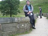
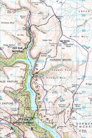
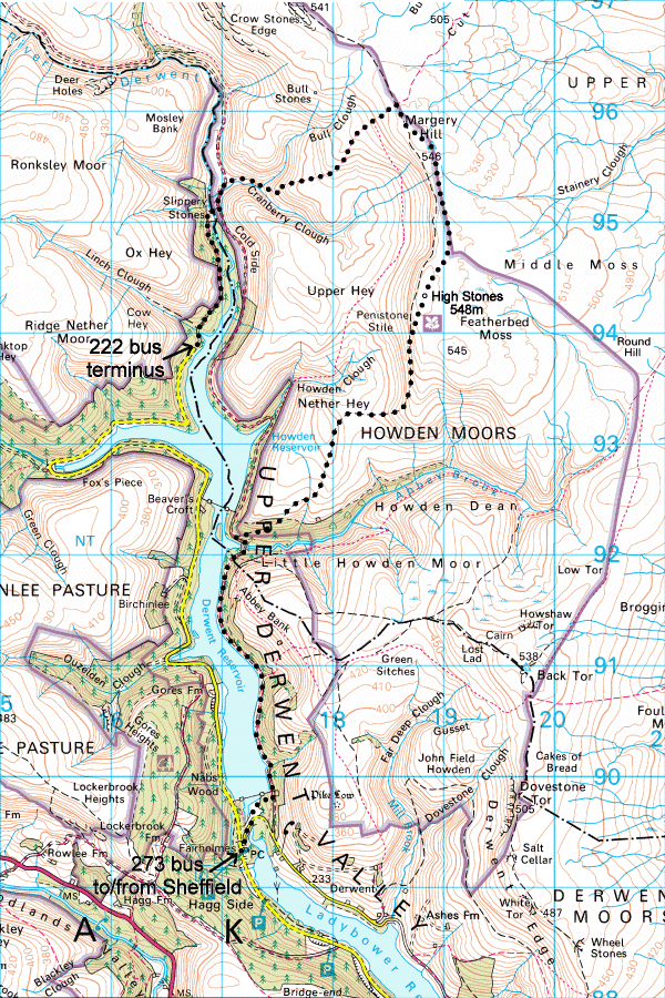
I caught the 273 bus from Broomhill at 11:17. £3.70 return to Derwent
Fairholmes at the top of Ladybower Reservoir. A ten-minute wait for the
number 222 bus at 12:12 up to King's Top, 270m above sea level, at the top
of Howden Reservoir - only 55p! From there a short walk to Slippery Stones
and the old packhorse
bridge crossing into Sheffield.
|
|
|
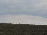
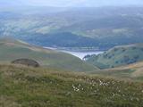
From there a steep climb up Bull Clough to Margery Hill in the distance
here.
|
|
|
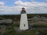
It took 90 minutes to get to the top,
I made it to the
triangulation point.
|
|
|
Because of the pillar, it is marked on the 1:50,000 map, and people think
it is Sheffield's highest point. However, off in the
distance is our
destination, High Stones.
|
|
|
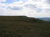
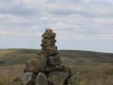
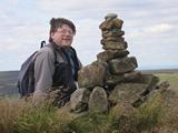
The top of the moors is very flat and soggy, so it took another half hour to
get across. You need a good sense of direction, or a compass or a watch and
sight of the sun, but finally,
here is High Stones,
and proof that I got
there. With the two-foot cairn, it's 1800ft above sea level! A 278m climb
from King's Top, arriving at 2:00pm. You get a great mobile phone signal
there :)
|
|
|
After sandwiches at the top of the world, a gentle stoll down the other side
of the hill takes you back to
Derwent and crosses
back into Derbyshire. The waterside road takes you back to the 273 bus stop,
decending 338m down to 210m above sea level, arriving at Fairholmes car park
at 3:30. Just time for a cup of tea before catching the 3:47 number 273 bus
back to Broomhill.
|
|
|
Just over 12km walk (7 miles), with about 1km of strenuous climbing. I well
recommend it.
Map here.
|
|

 Authored by J.G.Harston
- Last update: 27-Jul-2008
Authored by J.G.Harston
- Last update: 27-Jul-2008