Jonathan at the Wakefield Show   
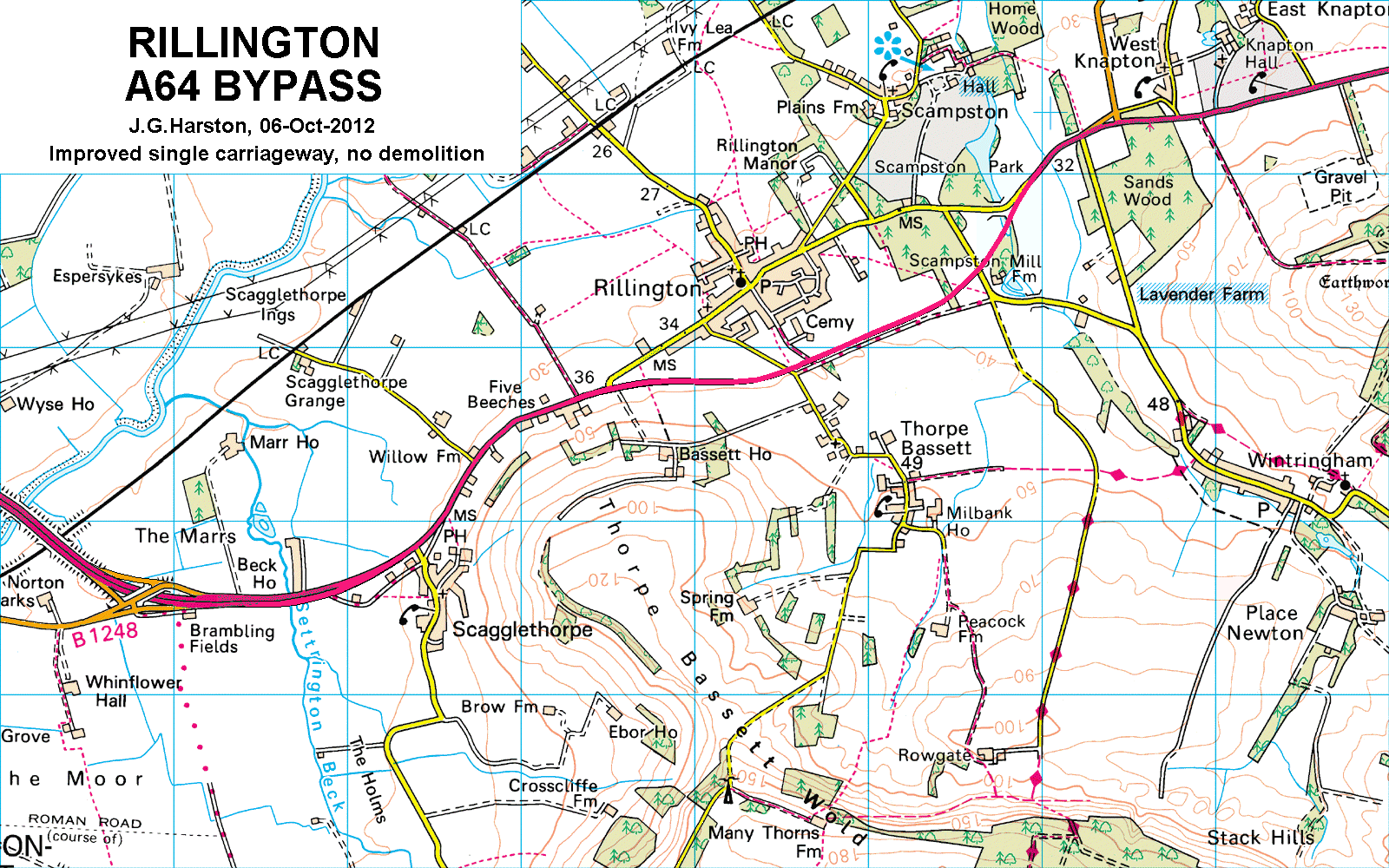
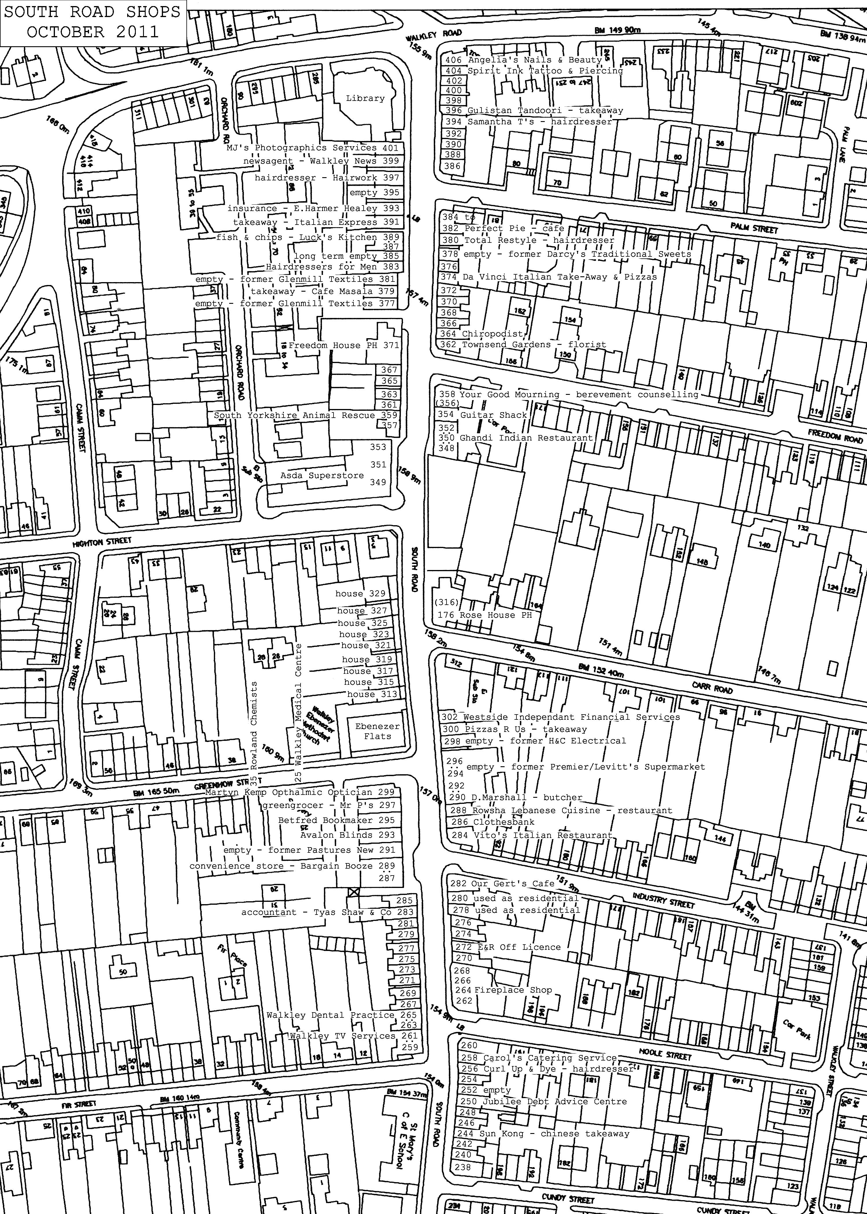
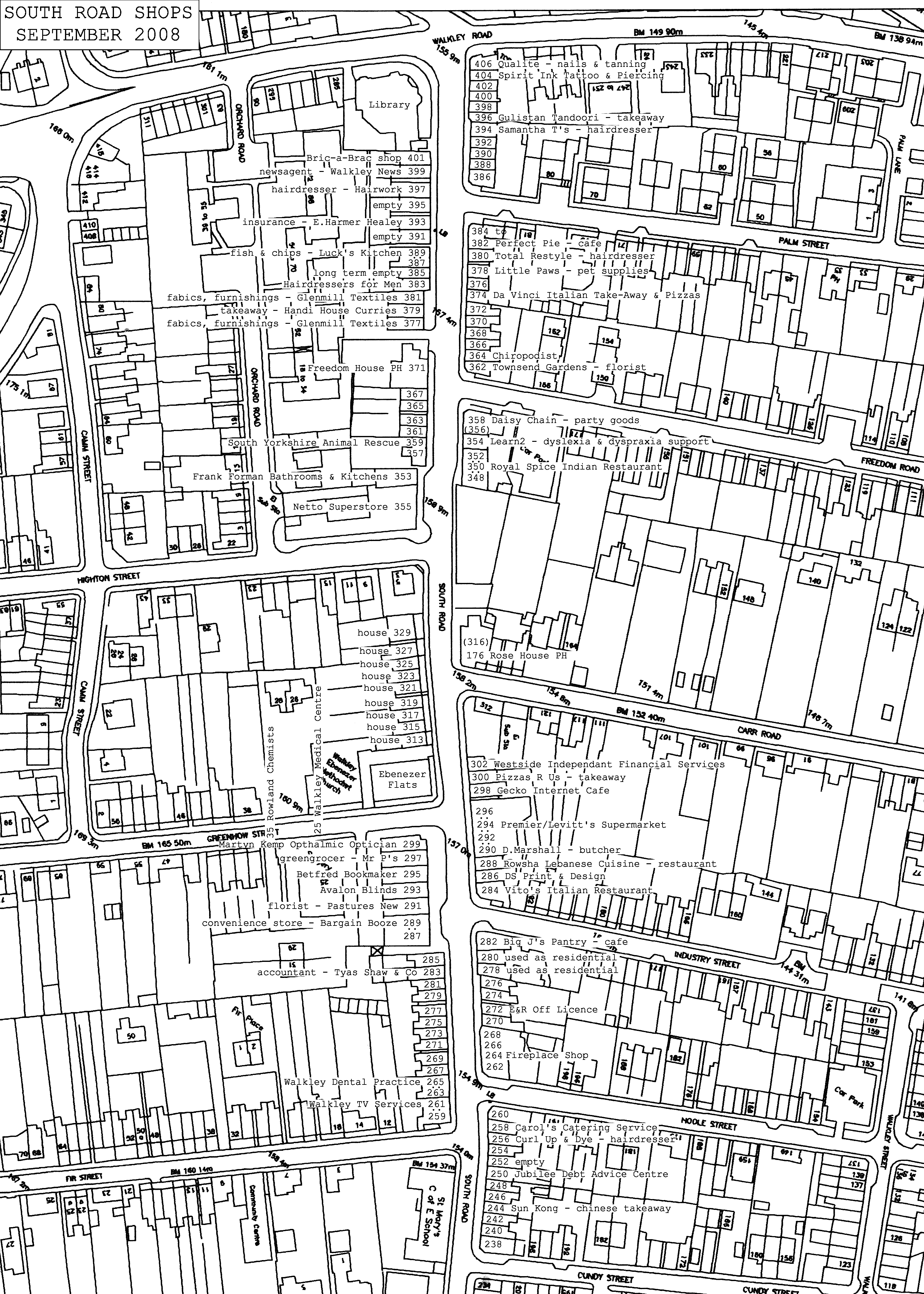
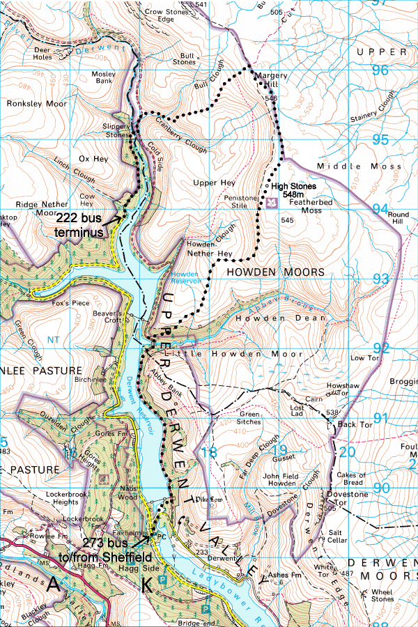
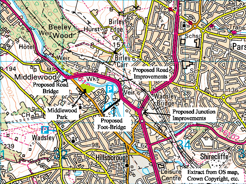
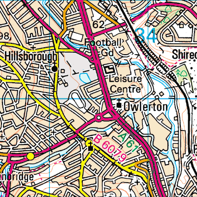
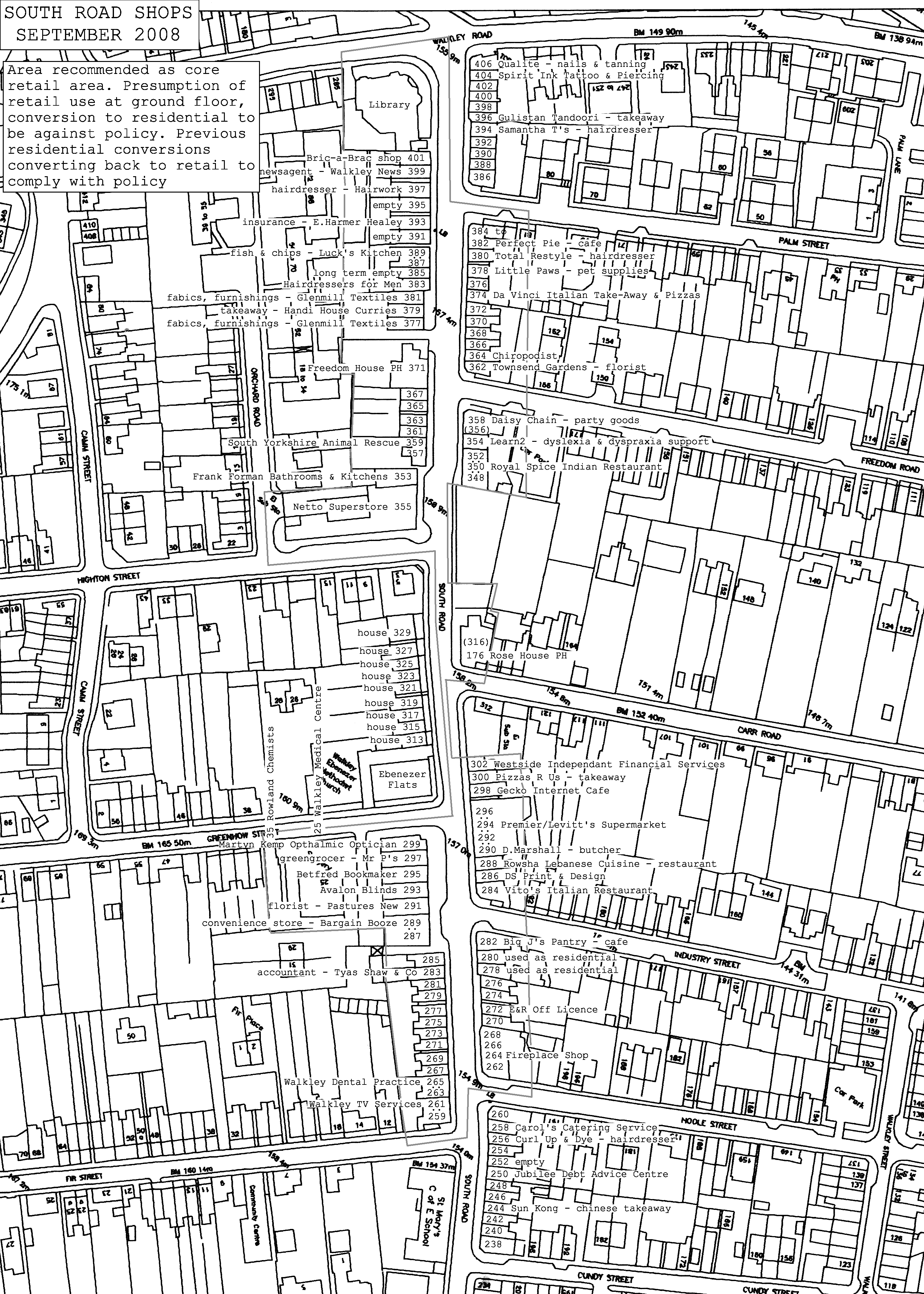
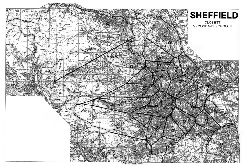
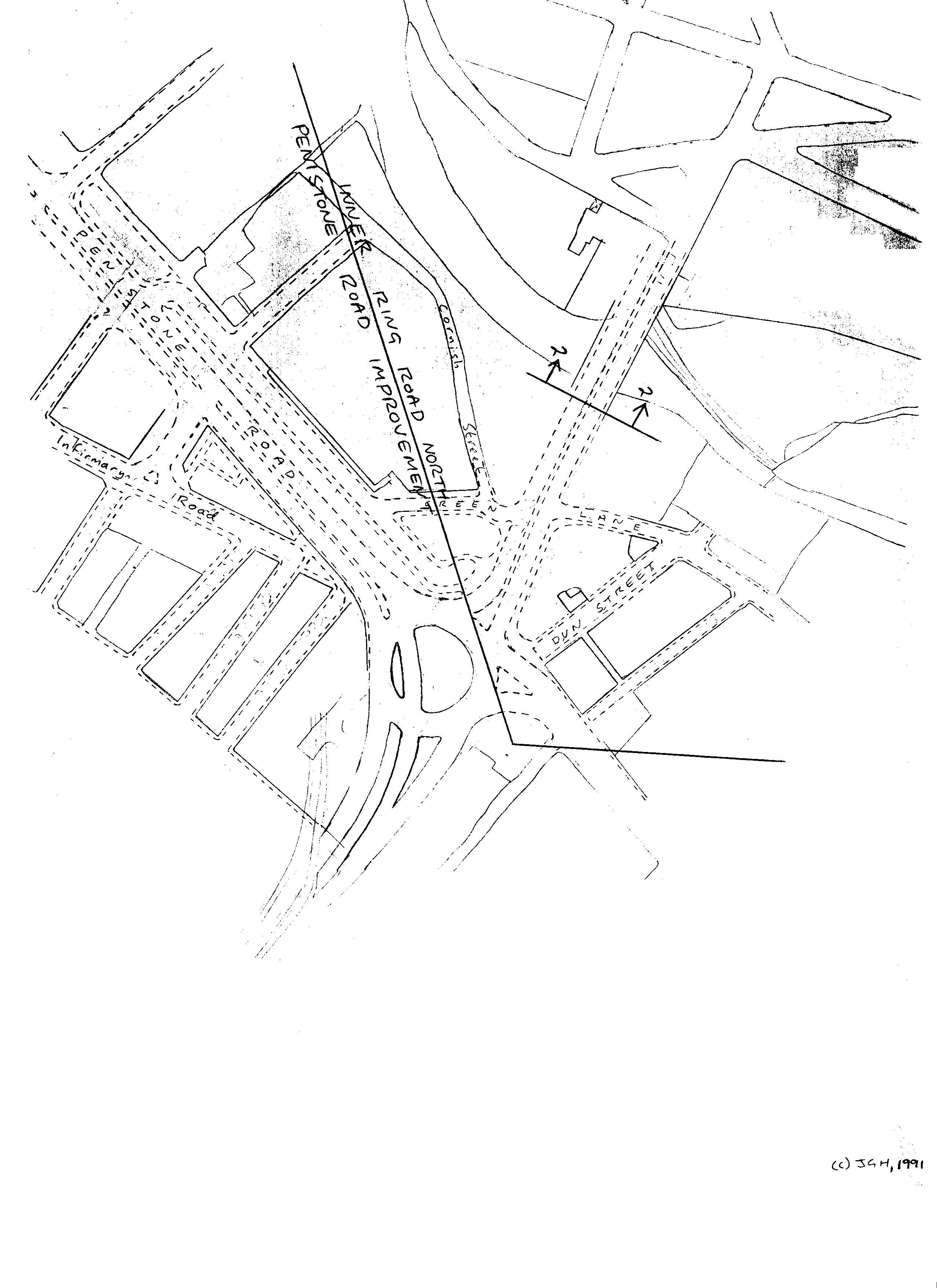
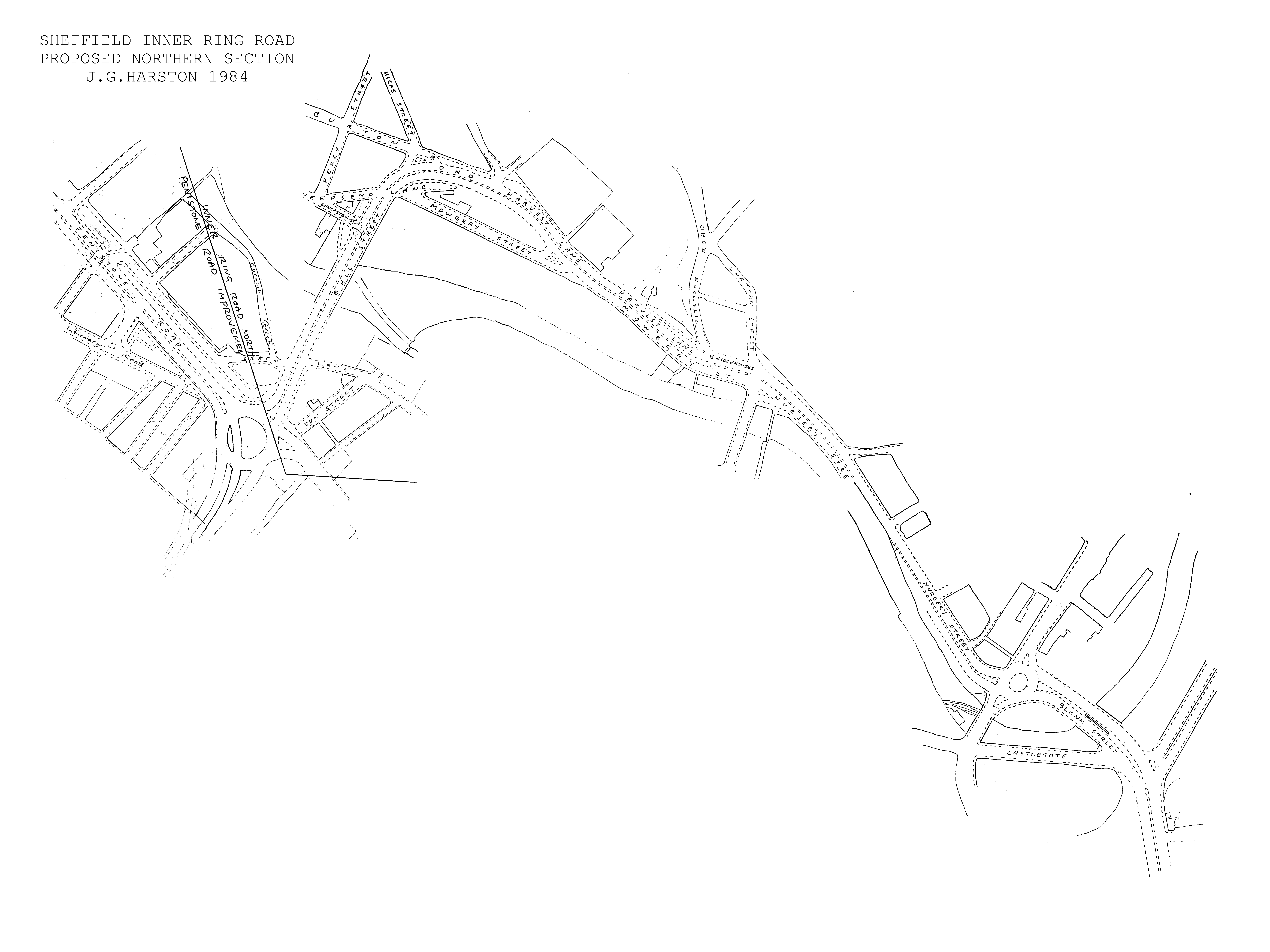
Jonathan Harston
  Maps
  email address

temporary content
  • 2012 Rillington - Proposed Rillington A64 bypass
  • 2011 SouthRdShops2011.gif - South Road Shops 2011
  • 1995-2010 CityMaps - Sheffield Election Maps
  • 1989-2009 YofWhitby - Yards of Whitby
  • 2008 Rockall - Rockall
  • 2008 SouthRdShops2008.gif - South Road Shops 2008
  • 2008 HighStones.gif - High Stones Round Walk
  • 2006 Bridge2.gif - Claywheels Lane Bridge Layout
  • 2006 Bridge.gif - Claywheels Lane Bridge
  • 2006 Bypass.gif - Claywheels Lane Bypass
  • 2005 Hills - Seven Hills of Sheffield
  • 2005 Borders - Sheffield Borders
  • 2005 Cuthbert50k.gif - Cuthbert Bank
  • 2005 Cuthbert.gif - Cuthbert Bank
  • 2005 stony.htm - Stony Walk
  • 2005 SouthRdCentre.gif - South Road
  • 2005 SecondarySm.gif - Sheffield Secondary Schools
  • 2004 ParlReview - Sheffield Parliamentary Review
  • 2002 WardReview - Sheffield Ward Review
  • 2000 SouthRd110.gif - South Road version 1.10
  • 1996 SouthRd100.gif - South Road version 1.00
  • 1985 Inner/50k.gif - Inner Ring Road North Section
  • 1985 Inner/10k.gif - Inner Ring Road North Section
  • 1985 North3.gif - Inner Ring Road North Section
  • 1985 North2.gif - Inner Ring Road North Section
  • 1985 North1.gif - Inner Ring Road North Section
  • 1985 North.gif - Inner Ring Road North Section
  • OSGrid - OSGB Grid Maps
  • ChanIsles - Channel Islands
  • DonValley - Don Valley Railway
  • maps - Sheffield Ward Maps