| Sheffield Ward Boundary Review 2013 |
| MDFS::maps.Sheffield.lgbr2013.Broomhill | Search |
|
When drawing up the Fulwood/Broomhill boundary in 2002 all respondants had great trouble as the line ran
through the Sheffield University halls of residence on Endcliffe Crescent. Moving the line by a few
feet changed the electorate by 1000! The Broomhall ward ended up being a collection of all the leftover
bits from the surrounding wards, creating a very odd shape and a strange and disparate collection of areas.
It would be better to revert to a model with a "horizontal" Broomhill ward that put all the university halls
in the same ward and was based on the main Whitham Road/Fulwood Road spine.
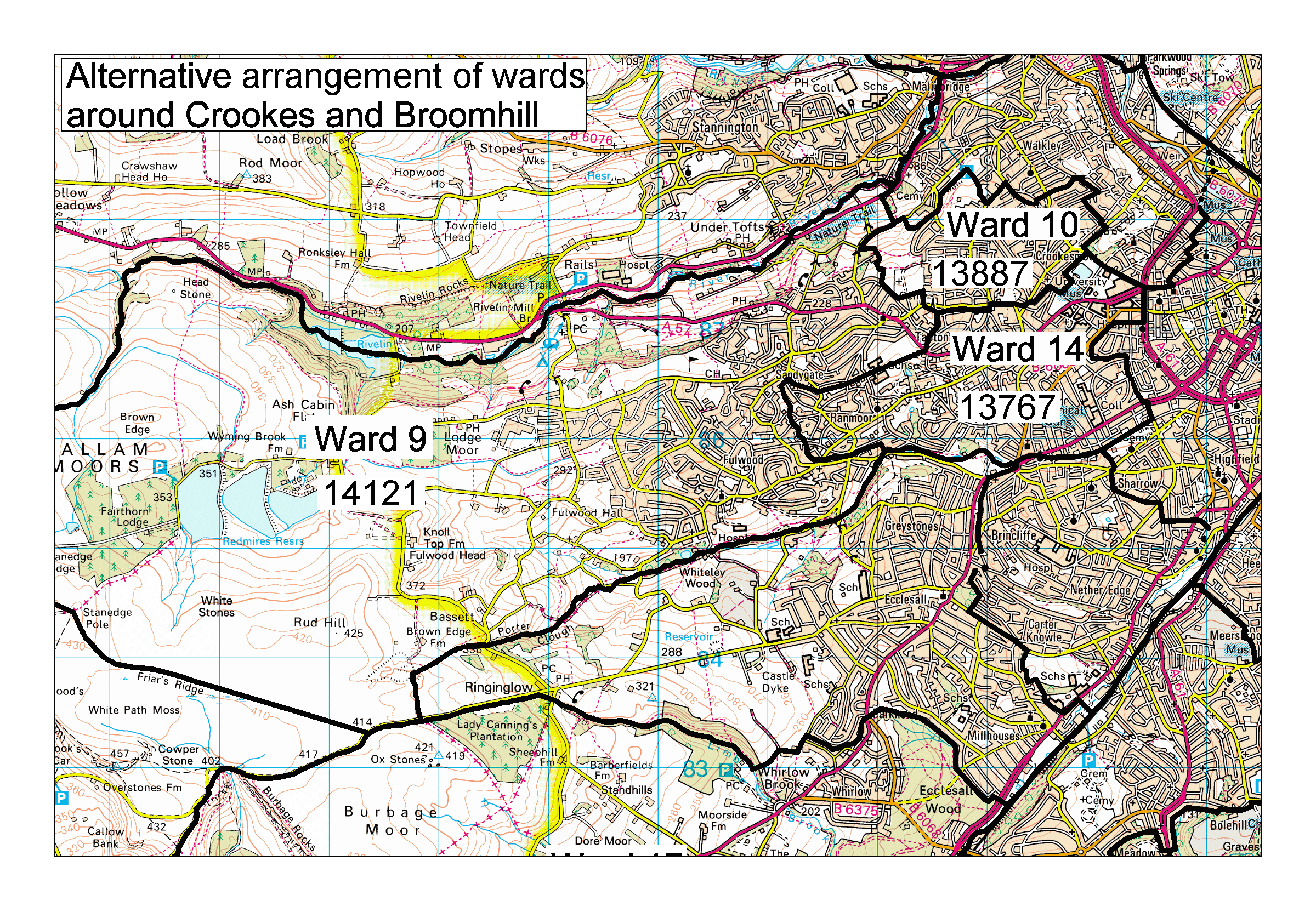
| I drew up a last-minute recommendation to do this, but it was too late for the 2002 review (map with 2013 figures). This would be a good model to base the wards on in this area. The Walkley/Crookes, Crookes/Broomhill and Broomhill/Ecclesall/Nether Edge boundaries are inflexible, if any adjustment is needed it would have to be by Crookes expanding westwards into Crosspool and pushing Fulwards correspondingly eastwards into Ranmoor. This is possible as long as the eastwards push does not go any futher than the Oakwood Brook running from Tapton School to Notre Dame School. |